June 2, 2011
PENTAX O-GPS1
A handy GPS unit for digital SLR cameras,
offering innovative features for effortless tracking and photographing of celestial bodies
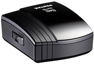
HOYA CORPORATION PENTAX Imaging Systems Division is pleased to announce the launch of the PENTAX O-GPS1. Designed for use with PENTAX digital SLR cameras, this versatile GPS unit not only gives basic location data, but also offers an array of original features that allow for the effortless tracking and photographing of celestial bodies.
Simply by mounting the O-GPS1 onto the hotshoe of a PENTAX digital SLR camera,* the user can record the latitude, longitude, altitude, universal time coordinated (UTC) and aspect of shooting locations onto captured images. Image files carrying GPS location data, can be used to track shooting locations and review location data on a PC. GPS location data stored on such files also makes it much easier to sort and file recorded images.
By coupling GPS data with the camera’s SR (Shake Reduction) system, the unit offers a range of unique, advanced applications, including ASTROTRACER, Simple Navigation and Electronic Compass.
* Compatible models are the K-5, K-r and 645D (as of May
2011). Some of the O-GPS1's functions may not be available when used with the
645D.
Note: In order to use the O-GPS1 properly with a compatible PENTAX digital
SLR camera body, the camera's firmware must be updated to the latest version.
Major Features
-
GPS function for effortless recording of shooting location data
The O-GPS1 mounts on the hotshoe of a compatible camera and records the latitude, longitude, altitude, universal time coordinated (UTC) and direction of the shooting location onto captured images. Using mapping software such as Google Earth™, the user can easily recall shooting locations and directions on a map. This function is very helpful later in sorting and filing the recorded images.Note: When the O-GPS1 is used in locations where it cannot receive signals from GPS satellites, location data may be in error or missing.
-
ASTROTRACER for effortless astronomical photography
When mounted on the PENTAX K-5 or K-r camera body, the O-GPS1 also offers the advanced ASTROTRACER function,** which couples the unit with the camera’s SR (Shake Reduction) system for the effortless tracing and photographing of celestial bodies. The unit calculates the movement of stars, planets, and other bodies using the latitude obtained from GPS data and the camera’s alignment data (horizontal and vertical inclinations and aspect) obtained from its magnetic and acceleration sensors, then shifts the camera’s image sensor in synchronization with the movement of the objects.*** As the result, stars and other bodies are captured as solid points rather than blurry streaks, even during extended exposures. It also makes astronomical photography much simpler, as it requires only a tripod and eliminates the need for an additional accessory such as an equatorial telescope.** This function is available only when the O-GPS1 is mounted on a PENTAX digital SLR camera body equipped with a magnet-driven SR system.
*** The duration of ASTROTRACER operation may vary depending on photographic conditions.
-
Simple Navigation to indicate location data to a destination
The O-GPS1 offers a Simple Navigation function, which calculates the direction and distance to a given destination from the current position. The user can either locate destinations using location data stored on recorded images, or register and/or assign them by uploading location data created on a PC.******** At the time of purchase, the O-GPS1 has nine PENTAX international service centers as preset destinations.
-
Electronic Compass function to indicate and record direction
The O-GPS1 comes equipped with an Electronic Compass function, which displays the camera’s direction on its LCD monitor with great precision. Using the aspect of geomagnetism detected by its magnetic sensor and GPS location data, the unit indicates the aspect in relation to true north. The user can also record directional data on captured images.
-
Other features
- Simplified weather-resistant construction for use in light rain
- Independent power source (one AAA-size battery) to eliminate the need for power supply from the camera body
O-GPS1 Specifications
| Type |
Clip-on GPS unit |
| Recorded Information |
Latitude, Longitude, Altitude, Time (UTC), Direction |
| Receiving Function |
Tracking Channels: 50
Supports SBAS (WAAS/EGNOS/MSAS) |
| Acquisition Time |
Cold-start: approx. 40 seconds
Hot-start: approx. 5 seconds |
| Positioning Interval |
1 second |
| GPS Accuracy |
10m RMS |
| Data Format |
NMEA-0183 |
| Geodesics |
World Geodetic System (WGS84) |
| Electronic Compass |
Accuracy: ±5° (precise calibration)
Positioning Interval: approx. 8 times
Reference Direction: True North |
| Dimensions |
Approx. 49.0mm (W) x 33.0mm (H) x 59.5mm (D) |
| Power Source |
AAA battery x 1
(alkaline battery, nickel-metal hydride battery, or lithium battery) |
| Battery Life |
approx. 7 hours (23°C) / 4 hours (0°C) with alkaline battery
approx. 7 hours (23°C) / 5 hours (0°C) with nickel-metal hydride battery
approx. 12 hours (23°C) / 9 hours (0°C) with lithium battery |
| Weight |
Approx. 61g (including alkaline battery), approx. 50g (unit only) |
[ ASTROTRACER Tracking Time (approx.) ]
K-5
| Declination |
Focal Length |
| (°) |
200mm |
100mm |
under 50mm |
| 90 |
300 |
300 |
300 |
| 45 |
160 |
290 |
300 |
| 0 |
110 |
240 |
300 |
<sec.>
K-r
| Declination |
Focal Length |
| (°) |
200mm |
100mm |
under 50mm |
| 90 |
300 |
300 |
300 |
| 45 |
80 |
200 |
300 |
| 0 |
80 |
170 |
300 |
<sec.>
